


Researchers and Earth observation users can now access data from the 2 advanced radar instruments aboard the NISAR (NASA-ISRO Synthetic Aperture Radar) satellite. From July 20, processed data from the satellite’s L-band and S-band radars is being released continuously, enabling scientists to monitor land and ice movement, track changes in forests and wetlands, and support responses to natural hazards such as landslides and earthquakes.
The data release comes ahead of the 1st anniversary of NISAR’s launch on July 30, 2025, from Satish Dhawan Space Centre in India. Since launch, mission teams from the U.S. and India have calibrated the satellite’s instruments, refined algorithms, and monitored almost all of Earth’s land and ice-covered surfaces every 12 days. During this period, the satellite has captured detailed images of urban areas, farmland, landslides, earthquakes, sinking land in Mexico City, and polar regions.
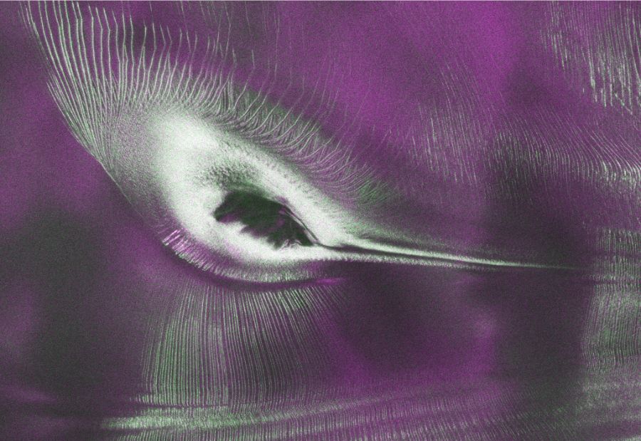
Among the latest releases is a remarkable radar image of East Antarctica that resembles a hummingbird. The image shows Nunatak Zaterjavshijsja, a mountaintop rising through a glacier flowing toward the ocean. The mountain creates stress in the moving ice, forming deep crevasses that appear as green lines in the radar image.
“First, it’s a beautiful image, with rich details of features that provide insights to how the glacier is moving. Then, because radar can often see through snow and deep into the ice, NISAR can observe fundamentally different properties of Antarctic ice than can be seen in optical imagery,” said Seongsu Jeong, the signal analysis engineer who produced the image. “With NISAR we’re seeing what’s hidden beneath the surface.”
The image was created using L-band measurements collected in August 2025 during satellite system testing. Radar signals with horizontal polarization appear magenta, indicating smoother ice surfaces, while vertically polarized signals appear green, revealing volume scattering from irregular features such as crevasses. White areas indicate a strong combination of both signal types.
NISAR is the 1st free-flying satellite to carry both L-band and S-band radar instruments. The longer-wave L-band can image beneath forest canopies, while S-band captures details of vegetation. S-band data is now available through the Bhoonidhi portal, while calibrated L-band data collected since June 17 can be downloaded from the Alaska Satellite Facility Distributed Active Archive Center. The mission generates dozens of terabytes of science data every day, covering nearly all of Earth’s land and ice surfaces.
Also read: Viksit Workforce for a Viksit Bharat
Do Follow: The Mainstream LinkedIn | The Mainstream Facebook | The Mainstream Youtube | The Mainstream Twitter
About us:
The Mainstream is a premier platform delivering the latest updates and informed perspectives across the technology business and cyber landscape. Built on research-driven, thought leadership and original intellectual property, The Mainstream also curates summits & conferences that convene decision makers to explore how technology reshapes industries and leadership. With a growing presence in India and globally across the Middle East, Africa, ASEAN, the USA, the UK and Australia, The Mainstream carries a vision to bring the latest happenings and insights to 8.2 billion people and to place technology at the centre of conversation for leaders navigating the future.